Rio Arapiuns: the guide from someone who lives on it
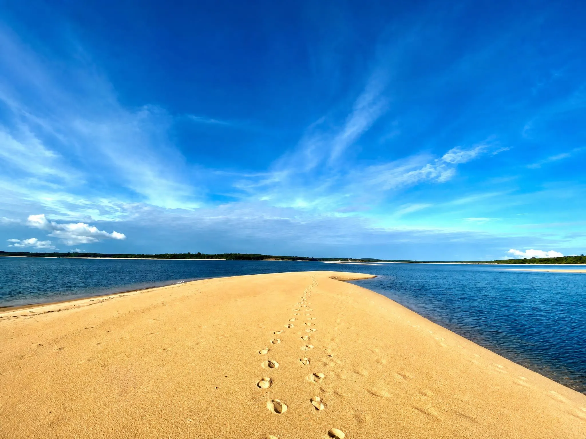
The Rio Arapiuns is a clearwater tributary of the Tapajós, in western Pará, 1.5 hours by boat from Alter do Chão. It runs entirely inside the Tapajós-Arapiuns Extractive Reserve, and it's where you find the white-sand beaches and clear water the Amazon rarely shows. From August to January the river drops and the beaches emerge; from February to June it floods and the landscape becomes flooded forest.
Almost everyone who arrives in Alter do Chão hears about the Arapiuns by the second day. It’s always the same line: “there’s a river nearby with even better beaches.” The line is true and explains little. This is the long version.
What the Arapiuns is
The Arapiuns is a clearwater river that rises in northern Pará and flows into the Tapajós near Alter do Chão. From its mouth to the communities further in, it runs through a stretch of protected land: the Tapajós-Arapiuns Extractive Reserve, created as a sustainable-use reserve — meaning, inhabited. The people who live there have the right to use the territory, and that’s what makes tourism on the Arapiuns different from tourism in a national park. You don’t visit an empty place; you visit a place where people live who decide how it’s used.
The first difference you see is the water. The Amazon River is muddy because it carries sediment from the Andes. The Rio Negro is dark because it carries tannin from decomposing vegetation. The Arapiuns is neither: it’s clear water, with a sandy bottom. You can see your own feet at waist depth.
The second difference is the sand. White, fine, in banks that appear in the middle of the river when the water level drops. From a distance it looks like a sea beach, minus the salt and the waves.
The river’s calendar
The Arapiuns has two years inside one. Understanding this is the most useful thing you can know before buying a ticket.
August to January — the dry season. The water level drops, the sandbanks emerge, and the beaches widen. It’s the “Amazon summer”: steady sun, little rain, and the river at its most inviting point of the year. October and November are the lowest point for the water level, which is the peak for the beaches. It’s also when the most people arrive.
February to June — the flood season. The river rises several meters, the beaches disappear underwater, and the forest along the banks goes under. This is when the igapó forms: you can paddle a canoe into the forest itself, between trunks and canopy, where months earlier there was dry ground. It’s not the beach season — it’s a different trip, quieter, and it’s when the Arapiuns belongs almost only to the people who live there.
July is the turning point: the river starting to drop, the beaches coming back.
If your question is “when should I go,” the answer depends on what you want to see, and there’s a whole piece just on that — the month-by-month calendar.
The places you visit
Names you’ll hear, and what they actually are:
Lago Azul. A lake of clear water connected to the river, reached by canoe. It’s the trip almost every visitor takes, and the one behind the photos that circulate.
Trilha da Samaúma. A walk to a large samaúma tree, starting from the community of Atodi. The samaúma is the Amazon’s cathedral tree — a trunk that takes several people with arms outstretched to circle.
Comunidade Coroca. Where you see the turtle conservation work and local crafts.
Ponta Grande and Ponta do Toronó. Beaches. Ponta Grande is where the sunset happens.
Canal do Jari. The narrow channel, forest on both sides.
A farinhada. The process of turning cassava into flour, done in the communities. It’s not a demonstration for tourists: it’s what happens there every week, and you can take part.
A tecelagem. Palm fiber woven by the artisans, including dyeing with urucum.
The piracaia
This one gets its own paragraph because it isn’t an activity, it’s a meal. River fish roasted in the sand, wrapped in banana leaf, by candlelight, served in a circle on the beach. It’s the end-of-day ritual here, and it’s the one thing almost every guest mentions afterward.
Mosquitoes, sun, and what to bring
The most common question deserves a direct answer: the Arapiuns’ white-sand beach doesn’t have mosquitoes. Clear water over a sandy bottom with open banks isn’t a breeding ground — the Amazon mosquito that looms in people’s imagination lives in the dark streams of dense forest and in muddy floodplain areas. That’s not a promise that no insect exists in the forest: on a forest trail, late in the afternoon, repellent is sensible. But the scenario people fear — not being able to eat dinner outdoors — isn’t the scenario here.
What really gets you is the sun. You’re close to the equator, reflected off clear sand and water. A hat, a long-sleeve shirt, and sunscreen aren’t overkill.
Bring footwear that can get wet: at several points you step off the boat straight into the water.
How to get there
Summarized here, because it has its own piece: fly into Santarém (STM) — direct from Manaus, Belém, and Brasília; with a connection from São Paulo — then a transfer of about 40 minutes to Alter do Chão, and from there 1.5 hours by boat upriver.
The trip is long, and it’s long on purpose. The boat stretch is what separates the Arapiuns from the flow of Alter do Chão, and it’s also the part where your head slows down. People who complain about the travel time on the way in usually complain less on the way back.
Where to stay
What’s available on the Arapiuns is limited, and that’s part of what keeps it the way it is. There are community-run guesthouses in the communities — simple, inexpensive, run by the residents themselves, and the best way to sleep inside the daily life of the river. And there’s Villa Arapiuns: thirteen bangalôs of tapajônica architecture, steps from the sand, for up to 26 guests, with full meals, solar power, and community-run operations. This is where we’re writing from.
From 15 people, the Villa operates as a full buyout — which suits retreats, groups of friends, and company teams who want the whole place to themselves.
Frequently asked
Where is the Rio Arapiuns?
In western Pará, in the municipality of Santarém. It flows down from the north and meets the Tapajós near Alter do Chão, which is where visitors start from — 1.5 hours upriver by boat.
Is the Arapiuns a blackwater or clearwater river?
Clearwater. That's why you can see the riverbed and the sand is white: the Arapiuns carries neither the sediment of the Amazon River nor the dark tannin of the Rio Negro.
Can you visit the Arapiuns in a day trip from Alter do Chão?
You can, and a lot of people do — but that's 3 hours of boat travel just for the round trip. To see the beaches, the communities, and the igapó without rushing, one night is the honest minimum; three or four nights is when the trip starts to be worth the travel time.
Do you need authorization to enter the reserve?
Visitors don't need to get authorization on their own. The RESEX is a sustainable-use reserve, home to riverside communities, and tourism happens with them — whoever organizes the visit handles the logistics.
Want to see it for yourself?
The conversation starts on WhatsApp: tell us your dates and group size, and we will build the rest around them.
More reading
Host your retreat on the Rio Arapiuns
A whole-property retreat venue in the Brazilian Amazon: thirteen bungalows, a covered pavilion, a yoga shala and a private freshwater beach, for groups from fifteen guests.
August 31, 2026
What community-based tourism is — and how it works in practice
Community-based tourism isn't tourism with a community visit tacked on. It's tourism where the people who live there decide, run it, and get paid. How that works inside an extractive reserve on the Rio Arapiuns.
August 30, 2026
Tapajós or Rio Negro: which Amazon should you choose?
Almost every Brazilian Amazon lodge sits on the Rio Negro near Manaus. The Tapajós is the other option, and the two give you genuinely different trips. An honest comparison.
August 29, 2026